Archive for November 2009

Terremoto!

November 13, 2009

We experienced our first earthquake (terremoto, temblor) here in Chile last night just after midnight. Em and I were watching a movie (Sunshine Cleaning Service) on our computer in our room when the rumbling began. Slowly at first it built to a climax. We live on the second floor and it was definitely rocking and swaying, but nothing fell over or collapsed. It seemed to last 20 seconds. The electricity cut out. We grabbed our headlamps and conferred with our upstairs neighbors and everything was fine there. Then we headed downstairs to check things out. Mario and Kitxi were out, and the boys slept through the whole thing. We checked to make sure everything was intact downstairs. It was. No damage, just the electricity was out. The electricity was out for about 40 minutes. We went back to watching our movie on computer battery power. The quake measured 6.5 and triggered no tsunamis. Spurred by the shaking a local marching band hit the streets in the dark. They were probably disappointed when the lights came back on in the middle of their performance. If the house is a rockin’ don’t bother knockin’.

Below is the cut and pasted AP blurb on the quake:

SANTIAGO, Chile — A strong earthquake struck northern Chile early Friday, briefly knocking out power to a city but otherwise causing no major damages, authorities said.

The 6.5-magnitude quake’s epicenter was between the cities of Iquique and Arica, about 60 miles (95 kilometers) from each, according to the U.S. Geological Survey. It hit just after midnight Friday local time (0305 GMT Friday; 10:05 p.m. Thursday EST).

Chile’s National Emergency Office put the quake’s magnitude at 5. It was unclear why the readings were different.

The office said the quake knocked out electricity in the city of Iquique but power was restored in minutes.

The quake had a relatively shallow depth of 6 miles (10 kilometers), according to the USGS.

Powerful earthquakes are common in the South American nation, which stretches along the quake-prone Pacific “Ring of Fire.”

Addendum: After several conversations about the earthquake, it seems there is a distinction between the words terremoto and temblor. Terremoto refers to a severe, disastrous earthquake (maybe over 7 on the Richter Scale) where houses collapse, people die, etc…Temblor refers to a more mild earthquake (under 7) which shakes the earth but does not really cause any damage or disaster. Akin to earthquake vs. trembler in English. But a 6.5 is an earthquake in English! So, I will stick with my more dramatic Terremoto! headline. Besides, I like the sound of that word better. It sounds stronger and vaguely Japanese.

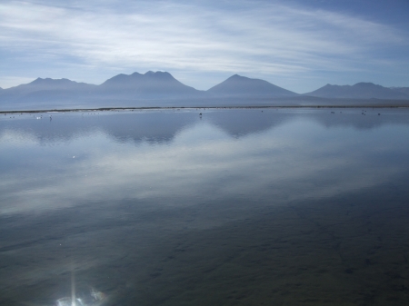
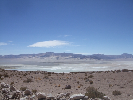
Salar de Coposa y Salar de Huasco

November 12, 2009
 

2009_11070018
Salar de Coposa

Travel Dates: November 5-7, 2009

With the teacher strike dragging on into its third week, our free time continues unabated. We took advantage of some of it last week by once again renting the car we rented the previous week. They delivered the car to our house at 1:00 pm on Thursday. It was ours for the next 48 hours (32,000 pesos). We loaded up, stopped by Lider for supplies, and hit the roads of Tarapaca, gassing up in Alto Hospicio. Our destinations this time were the Altiplano salt flat lagoons of Salar de Coposa and Salar de Huasco.

2009_11070038

Mirador de Salar de Huasco

2009_11070069

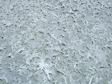
Sal

From Pozo Almonte we headed east towards the Andes. Several kilometers east of Pozo Almonte, the paved road splits: Mamina to the left and the lagoons of the Altiplano to the right. We headed to the right. The road headed through the Atacama and soon began climbing steeply through the pre-cordillera up to the Altiplano and the big vacant. There is nothing along the road for a 100 plus kilometers, until you reach the end of the paved segment at the Carabinero/Border Control station just past Salar de Coposa. Just beyond the station, lies the behemoth copper mine of Collahuasi. The whole reason the road is paved to this remote location in the first place. The mine seems to control this whole area. A sort of nation within a nation. Guardians, users, and abusers of the abundant nature including the lagoons which they draw water out of, to the detriment of the shrinking lagoons and the birds that depend on them. 98% of the traffic on the road was mine traffic. Lots of semis hauling supplies up the long grades, buses filled with miners heading to and from work, and company pick up trucks with their long CB antennas. We were pretty much the only passenger car climbing the switchbacks and long grades. Not many tourists make it out this way.

2009_11070093

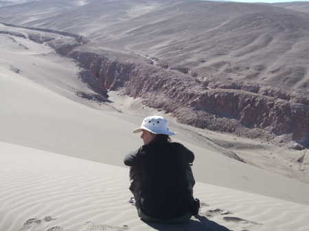
Pre-cordillera dunes

2009_11070099

Caminando en las arenas

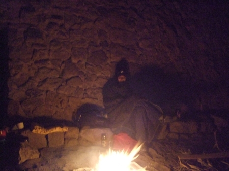
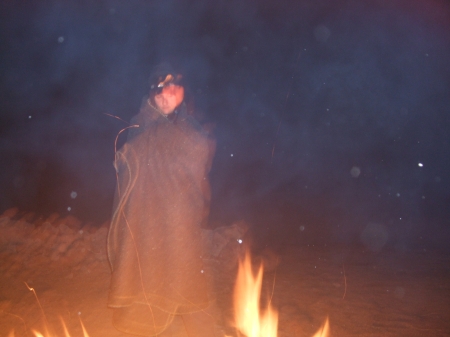
 We took the road just past Salar de Coposa and turned around at the control station, gathering wood from along side the road for a fire later. We pulled back into the overlook of Salar de Coposa and enjoyed the sunset and alpine glow on the lagoons, salt flats, and Bolivian/Chilean Andean border. The wind was howling in its usual high elevation afternoon manner. Salar de Coposa sits at around 3,700 meters. The night would be a cold one, but the wind would die down after sunset. We pulled back up the road a kilometer, next to a seasonal refugio used by llama herders. We tucked the car in next to a stone wall and set up a fire pit nearby at the angle of two walls mostly out of the wind. As the temperature dropped, we fed the fire and enjoyed the stars and sounds of flamingos and other Altiplano birds out in the shallow lagoons. When we ran out of wood, we sat by the coals gathering warmth for a frosty night sleeping in the car.

2009_11070006

Toasty

2009_11070013

Flames

2009_11070084

Auto Frio

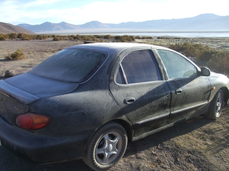
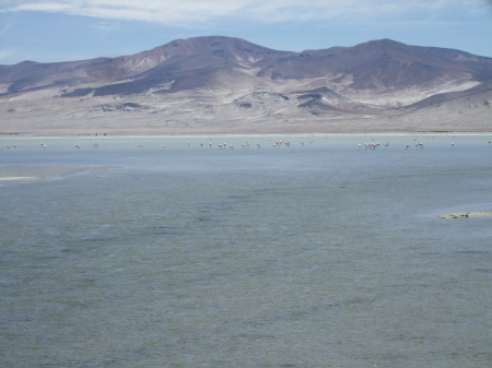
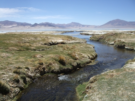
We awoke with the sun burning through the windshield frost. We warmed our chilly bones with an hour and a half walk out in the lagoon laced flats, filled with flamingos and an array of other birds and backed by the Andes. After our morning walk and brunch, we headed back down the road towards Salar de Huasco, which sits about 10 km off the main paved road down a winding washboarded gravel road. Along the way, we saw one other vehicle. It was speeding towards us. It was the Carabineros. They stopped next to us and motioned that they wanted to talk. After greetings, they asked us where we were from, where we were going, and to show them our passports. We obliged, handing over our passports and Carnet (Chilean Identification Card) to them. We passed inspection with flying colors and they bid us a fond farewell before racing off again in the opposite direction. We continued on our way, and dropped down steep switchbacks to the flats of Salar de Huasco, where we would spend the rest of the day. Salar de Huasco sits around 4,000 meters. We pulled into a flat spot along the flats and roamed the edge of the big lagoon, filled with flamingos roaming and feeding in the shallow water, occasionally taking to the wing framed by the Andes beyond. After a nice walk, we retired to the car for a mid-day nap out of the intense Altiplano sun and then enjoyed another long llama and flamingo filled walk around sunset.

2009_11070049

Flamencos de Salar de Huasco

2009_11070045

Salar de Huasco creek

2009_11070065

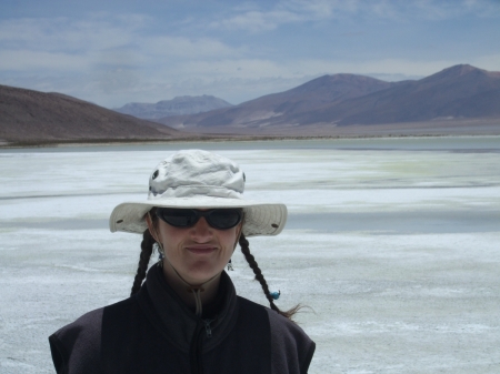
Mujer de Sal

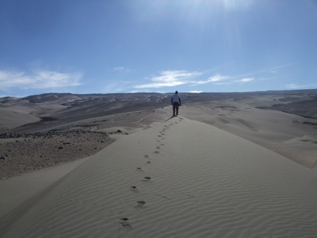
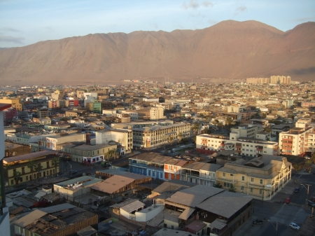
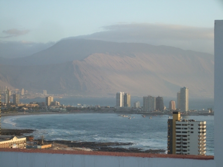
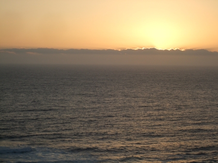
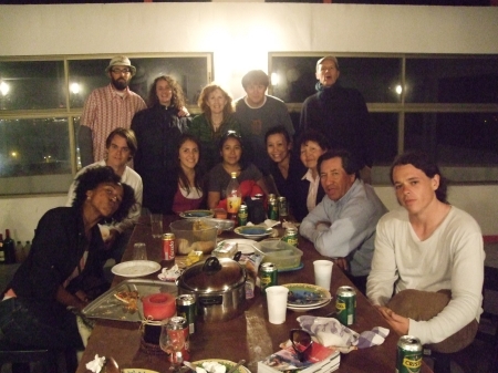
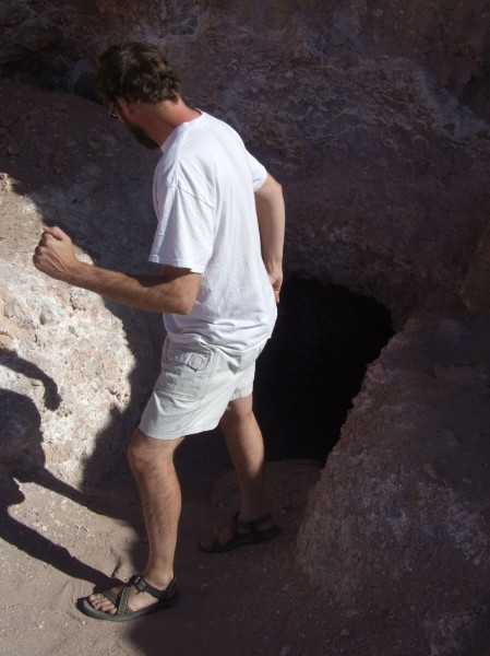
Another frosty night was spent around a roaring fire and then cuddled against the cold in the car. Once again, we awoke with the sun burning through the thickly frosted windows inside. Our toes were cold after the chilly night and we warmed up with the heat cranked as we hit the road back to Iquique, dropping out of the Altiplano, through the pre-cordillera and the desert flats, and ultimately down to the Pacific. Along the way, we stopped to roam some pre-cordillera sand dunes. We dropped the car back off at the rental office at 1 pm after unloading and decompressing a bit at home. After dropping off the car, we spent a nice day relaxing at home before heading out for a great Iquique volunteer party on the party patio on the 20th floor of David and Cushla’s apartment building into the wee hours of the morning. Iquique is much more pristine from 20 floors up, like looking at the world through rose tinted glasses.

2009_11070100

Calles de Iquique

2009_11070102

Vista de 20 piso

2009_11070104

Mar de Iquique

2009_11070107

Voluntarios y amigos de Iquique


Monumentos al Pasado

November 9, 2009
2009_10310049

Running from history

Travel Dates: October 30-31, 2009

After a farewell swim and Frisbee session at Playa Seis, we jumped back in our rental car and climbed the switchbacks out of Pisagua into the open desert. Once we hooked back up with the Pan-American, we headed south. Our first stop was at a War of the Pacific battlefield, The Battle of Dolores. The memorial sits 3 km west of the Pan-American among groves of tamarugo and adobe ruins, commemorating the November 19, 1879 Chilean victory over Peru/Bolivia in the Tarapaca campaign.
2009_10310035

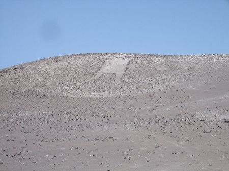
Gigante de Tarapaca

Our next stop was the biggest archaeological representation of a human in the world, El Gigante de Tarapaca (Atacama). The 86 meter tall El Gigante reclines on the west slope of Cerro Unita, a small hill in the middle of flat sprawling desert, 14 km off the Pan-American east of the town of Huara. Archaeologists believe the geoglyph dates from around 900 A.D and think it represents a powerful shaman, a mysterious monument baking in the sun and overlooking the sprawling Atacama below. Quoting the Lonely Planet: “Its skinny limbs are spread wide, and it clutches what seems to be an arrowhead in one hand and a medicine bag in the other. Its open mouth and owl-like head, topped by vertical rays (and horizontal lines only visible from above), give it the perpetual appearance of hair-raising shock.” The details of the Giant are most clearly seen from above. Begging the question: Who was flying around spying it from above in 900 A.D? One of many unanswered mysteries. Without access to a flying machine, we contented ourselves with the view of the Giant from below.
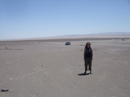
2009_10310037

Em, our car, and the Atacama below El Gigante

The Atacama is filled with geoglyphs, most of their meanings are mysterious. There is a huge cluster of geoglyphs at Pintados, 45 kilometers south of Pozo Almonte. The geoglyphs of Pintados are within the Reserva Nacional Pampa del Tamarugal and administered by CONAF (Corporacion Nacional Forestal ). After communing with El Gigante, we returned to the Pan-American and headed south towards Pintados. We stopped in Pozo Almonte to pick up some supplies on the way. At Pintados, 355 geoglyphs line the desert hills that sit overlooking a long, wide salt flat, Salar de Pintados. The geoglyphs include geometrical designs, human depictions, and animal depictions. To quote the Lonely Planet once again: “These enigmatic geoglyphs are thought to have served as signposts to nomadic peoples: marking the trade routes and meeting points, indicating the presence of water, identifying ethnic groups and expressing religious meaning. Most date from between AD 500 and AD 1450.” We spent two hours roaming the site and taking in all the intricate geoglyphs on the hills, pondering how, who, and why they were built.
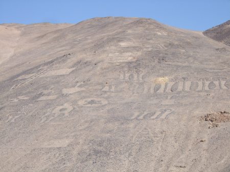
2009_10310041

Geoglyphs de Pintados

2009_10310042

Em and adobe wall at Pintados

2009_10310046

Looking down on Salar de Pintado

After Pintados, we headed east to the town of Pica for a nighttime swim under a big moon at Cocha Resbaladero. Following our swim, we headed back to the west, out of the green oasis of Pica and across bleak Atacama flats to hook back up with the Pan-American. We headed north on the Pan-American for 20 kilometers until we reached the roadside CONAF campground in Reserva Nacional Pampa del Tamarugal. The campground was deserted and we had it all to ourselves. It looked like it had recently been undergoing improvements to spruce it up. The sites were nice and big and cordoned off from each other in little compounds enclosed by combination stone walls and wood fences. Most of the sites included a nice tamarugo tree with a picnic table nestled underneath. We chose an end site and settled in, enjoying the rest of the night star and moon gazing amidst the tamarugos.
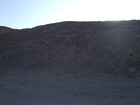
2009_10310056

Mas geoglifos de Pintados

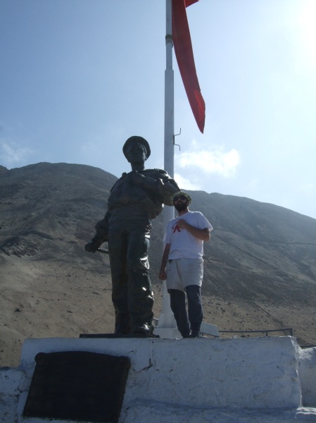
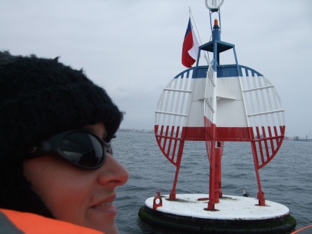
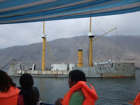
We were up early the next morning and on the road back to Iquique. We had to return the rental car at noon. We rolled back into Iquique at 9:30 am. With plenty of time to spare, we decided to visit Monumento al Marinero Desconcido (Monument to the Unknown Sailor) that sits along the coast to the north of town. It commemorates the May 21, 1879 War of the Pacific Battle of Iquique between Chile and Peru. The legendary Chilean ship, Esmeralda, captained by national hero Arturo Prat, which had plagued the Peruvian navy during the war with numerous heroics and naval victories, was finally sunk by the Peruvian monitor Huascar. After a prolonged battle, at 12:10pm, the Huascar finally scored the death blow. The iron clad behemoth rammed the wooden Esmeralda broadside and sent it to the bottom of the ocean. Captain Arturo Pratt famously rallied his troops to fight to the death and lept onto the deck of the Huascar wielding his sword. He fell dead on the deck of the Huascar and moved into the history books as one of Chile’s most treasured military heroes. His name spreads across Iquique: Avenue Arturo Prat, Plaza Prat, Universidad de Arturo Prat, etc….. and across Chile. His face graces the 10,000 peso note, and May 21 is a national holiday to commemorate Arturo and his men and their heroics in Iquique. The Esmeralda still sits on the ocean floor in the bay offshore of the monument. Its resting place is marked by a patriotic red, white, and blue buoy in the sea. A couple months ago, we took a harbor tour on a boat that took us out and around the buoy marking the heroic event. An upcoming movie focusing on the heroics of Arturo Prat and his final day was recently shot in Iquique. It included a re-creation of the battle with scaled replicas. The replica Esmeralda, like the real one, was sent to the bottom of the ocean, rammed by the replica 1/3 scale Huascar, which still sits anchored in Iquique’s harbor. There are plans in the works to build an Esmeralda replica for Iquique’s harbor. The real Huascar, captured by the Chileans later in the war, now sits in the harbor of Chile’s main naval base in Talcahuano in central Chile as a museum ship.
2009_09060022

Em and Esmeralda buoy

2009_10310058

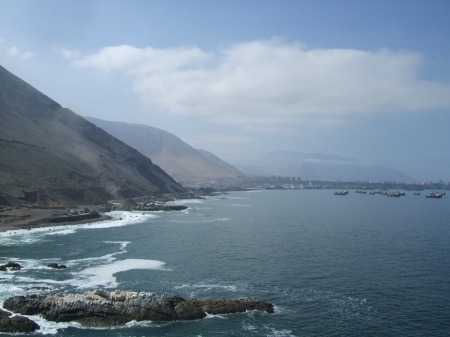
Fruits of victory: looking south towards Iquique

May 21, 1879 was not a total loss for the Chileans. The battle was two pronged: Esmeralda vs. Huascar, with the Huascar emerging victorious; and the Chilean fishing boat Covadonga versus the Peruvian frigate Independencia. The Covadonga emerged victorious in that battle. After a prolonged running battle, the Covadonga sunk the Independencia south of Iquique at Punta Gruesa, salvaging some of the day for the Chilean side against all odds. We sat on the cliff top memorial overlooking the sea contemplating naval heroics of the past and the denizens of Davy Jones Locker. Then, we made our way back through town to drop our stuff off at home before returning the rental car after a great 72 hours plying the roads and history of Tarapaca.
2009_09060016

Huascar 1/3 scale replica

2009_10310066

Monumento al Marino Desconcido